Monday, October 11, 2010

West Virginia


Date of Summit: Saturday, September 4, 2010

Mountain: Spruce Knob

Summit Elevation: 4,863 feet

After visiting the Bradley's in Stephen's City, Virginia one weekend, we opted to take the long way home and get up to the top of Spruce Knob, West Virignia's highest point. We drove South on Interstate 81 through Shanandoah Valley for a while before heading west to the 'Wild and Wonderful' state of West Virginia. Lucky for us the high point is only a few miles west of the border down some narrow, winding roads.


We were a little disappointed to find that the trailhead for the hike is only 1/4 mile from the top of the mountain, so most of the elevation-gain "hiking" was done by the 4 cylinders of our Toyota Camry. Turns out that wasn't such a bad thing, as it was surprising cool up there and we were still dressed for summer.


We put Cai's pajamas over his clothes to help him stay warm for the little hike. The only other warm thing we had was Cai's little Choo-Choo train blanket.


This is the view of West Virginia (looking west) from its highest point, Spruce Knob. There is an observation tower on top of the mountain so we could get above the trees and enjoy the vista.


We had a lot of fun bouldering on these chunks of granite near the top. Cai's shoes wouldn't fit over his pajamas but he thought it was so fun to walk on the rocks on his feet.


There was a small divit in a rock and some water had collected in it. As soon as Cai saw it he was so excited because he figured that was his first time seeing a real volcano!


Cai's trip to Spruce Knob, the highest point in West Virginia!

Saturday, August 29, 2009

Utah County High Point

Date of summit: Tuesday, July 21, 2009

Mountain: Mt. Nebo

Summit Elevation: 11,928 feet

We hiked up a county high point and since we haven't hit any state high points in a long, long time we want to add Mt. Nebo to the blog.

We came a few days before the family reunion to hike some mountains in Utah. On July 21, 2009 we made it as a family to the top of Mt. Nebo, the highest point in Utah county. The elevation is 11,928 feet. We continued our tradition of carrying Cai up the mountain in the pack, even though he is now close to 25 pounds. Quite a difference from last year's hiking with a 10 pound baby.


3/4 the way up the beautiful trail


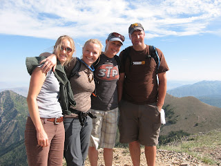
Jewelene, Elana, Pam, & Travis on top


Cai and his daddy on top of Mt. Nebo.


Elana & Carter's


Family photo looking North towards Utah Valley

Thursday, May 1, 2008

Washington D.C.

Date of summit: Tuesday - April 8, 2008


Mountain: Not much of a mountain - Fort Reno Park


Summit Elevation: 429 feet


On our way home from Katie's house we visited Washington D.C. Although it's not an official state, it does have a high point that we decided to visit.

Fort Reno in Washington D.C. was our 3rd overall high point.

Fort Reno was an old Civil War fort. It's near a high school just off Nebraska St. and wasn't too long of a hike (less than 100 yards and only 5 feet elevation gain from the street).


Jarad and Cai at the high point - Fort Reno.


The Washington D.C. Temple of the Church of Jesus Christ of Latter-Day Saints is our spiritual high point. We took turns visiting the temple and babysitting Cai.

Wednesday, April 30, 2008

Virginia

Date of summit: Saturday - April 26, 2008

Mountain: Mt. Rogers

Summit Elevation: 5.729 feet


We set out on our spring break for an Appalachian adventure. Our goal was to hike to the high point in each of six states - North Carolina, South Carolina, Georgia, Tennessee, Kentucky, and Virginia. We planned 4 days for the 1,500 mile road trip that would include up to 23 miles of hiking. Each state will get its own post. Unfortunately, you won't find one for Kentucky because we ran out of time and didn't make it! We came home happy (and exhuasted) though with 5 state high points.

Mt. Rogers was our 5th and last high point on our Appalachian adventure and our 8th high point overall.

Mt. Rogers has been one of our favorite high point hikes so far. Most of the mountain is only lightly forested, providing great views along the way. Surprisingly, the very top of the mountain is the only part of the hike that is heavily wooded (and there's not much of a view from the top).

The 9 mile round-trip hike was a good workout in distance, but the elevation gain from the parking lot to the top was only 1,500 feet or so. A nice break from the steep summits we did in Georgia and North Carolina.


Jewels at the top of Mt. Rogers.


We crossed the Appalachian Trail a few times and hiked on it for a while too. We met an interesting English hiker who seemed very dissappointed that he wasn't the only person on the trail. There was also a scout group camping nearby.


The wild ponies up there on the range are very friendly!

What a great family hike!


This is the official geodetic survey marker at the top of Mt. Rogers.

Tennessee

Date of summit: Friday - April 25, 2008

Mountain: Clingman's Dome

Summit Elevation: 6.643 feet


We set out on our spring break for an Appalachian adventure. Our goal was to hike to the high point in each of six states - North Carolina, South Carolina, Georgia, Tennessee, Kentucky, and Virginia. We planned 4 days for the 1,500 mile road trip that would include up to 23 miles of hiking. Each state will get its own post. Unfortunately, you won't find one for Kentucky because we ran out of time and didn't make it! We came home happy (and exhuasted) though with 5 state high points.

Clingman's Dome in was the 4th high point on our Appalachian adventure and the 7th overall high point in the United States we have reached so far.

The Great Smokey Mountains of Tennessee!


Jewels and Cai on their way up to the observation deck at the top of Clingman's Dome, the high point of Tennessee. It's very near the North Carolina border.

It's only a 1 mile round-trip hike from the parking lot to the top of the mountain. It was a little chilly up top and it was enshrouded with the fabled "smokey" clouds.


Tennessee has built this nice observation deck and has great displays and views from the parking lot too.

After leaving the top of the Smokeys we drove through Gatlinburg (Vegas for rednecks - a unique, fun place!), and then spent the night in a hotel - after 2 nights of camping and over 800 miles of driving, a hot shower and clean bed was very comforting! Cai sure enjoyed it too.


Georgia

Date of summit: Friday - April 25, 2008

Mountain: Brasstown Bald

Summit Elevation: 4,784 feet

We set out on our spring break for an Appalachian adventure. Our goal was to hike to the high point in each of six states - North Carolina, South Carolina, Georgia, Tennessee, Kentucky, and Virginia. We planned 4 days for the 1,500 mile road trip that would include up to 23 miles of hiking. Each state will get its own post. Unfortunately, you won't find one for Kentucky because we ran out of time and didn't make it! We came home happy (and exhuasted) though with 5 state high points.

Brasstown Bald was the 3rd high point we reached on our Appalachian trip and the 6th overall high point we have made it to so far.

The highpoint in Georgia is one you can usually drive to (almost- just a 1/3 mile hike from the parking lot on top). It would have been nice to drive it because we were limited on time, but the spur road off of Highway 180 was closed since they were preparing for the Tour de Georgia bike race. The ranger pointed us to a small, steep trail that would take us to the top if we were willing to make the 6 mile round-trip hike.


So of course we did it! Here's Jewels up on top of Brasstown Bald - the highest point in Georgia. We had to go fast since thunderstorms were coming our direction rather quickly.


A view from on top of the nice observation deck/museum towards the south, overlooking the beautiful Georgia countryside.


South Carolina

Date of summit: Thursday - April 24, 2008

Mountain: Mt. Sassafras

Summit Elevation: 3,560 feet


We set out on our spring break for an Appalachian adventure. Our goal was to hike to the high point in each of six states - North Carolina, South Carolina, Georgia, Tennessee, Kentucky, and Virginia. We planned 4 days for the 1,500 mile road trip that would include up to 23 miles of hiking. Each state will get its own post. Unfortunately, you won't find one for Kentucky because we ran out of time and didn't make it! We came home happy (and exhuasted) though with 5 state high points.

Mt. Sassafras was our second high point on our Appalachian adventure and our 5th overall high point.


Here we are on top of Mt. Sassafras - the highest (wimpy) peak in South Carolina. It's also on the North Carolina border and the trailhead parking lot is only 200 yards or so from the top of the hill. The Appalachian Trail cuts right across the top of the mountain. Right here on Sassafras was where we spent our second night.

North Carolina

Date of summit: Thursday - April 24, 2008

Mountain: Mt. Mitchell

Summit Elevation: 6,684 feet

We set out on our spring break for an Appalachian adventure. Our goal was to hike to the high point in each of six states - North Carolina, South Carolina, Georgia, Tennessee, Kentucky, and Virginia. We planned 4 days for the 1,500 mile road trip that would include up to 23 miles of hiking. Each state will get its own post. Unfortunately, you won't find one for Kentucky because we ran out of time and didn't make it! We came home happy (and exhuasted) though with 5 state high points.

Mt. Mitchell was the first high point on our Appalachian adventure and the 4th overall high point we have visited.

After camping on the shore of Lake Norman (just north of Charlotte) we drove 2 1/2 hours on windy mountain roads including the famed Blue Ridge Parkway until we arrived at the visitor's center of Mt. Mitchell. Not only is Mt. Mitchell the highest point in North Carolina, it is also the highest point East of the Mississippi River


From the visitor's center there is a road that you can drive up to 1/4 mile of the summit. We opted to hike the 5 mile round-trip from the visitor's center. We really wanted to earn this one since it was the first on our Appalchian quest.

The hike was steep and the weather was great! Some clouds kept us out of the sun and the temperature hung around 55 degrees F. We're glad we did these in April before it gets really hot. The actual summit was blocked off by a gate because they are building an observation deck up there. From the parking lot on top to the proposed observation deck is only a quarter mile or so. There were no construction workers or rangers around so we went under the gate and got to the top. There was a Korean couple from California trying to get all the high points too. They came with us to the summit.

Sunday, April 13, 2008

Pennsylvania

Date of summit: Monday - April 7, 2008

Mountain: Mt. Davis

Summit Elevation: 3,213 feet

This was our second state "high point" in our quest to hike to the highest peak in each of the 50 states and beyond. We drove 2 1/2 hours from Katie's house in Winchester, VA then hiked about an hour to the top of Backbone Mountain, Hoye Crest, Maryland before continuing on to the Pennsylvania high point. It was about another 2 hours from the MD highpoint to the PA high point. We enjoyed a nice drive through an Amish village on the way to the mountain.

With rising fuel costs I think the Amish people have a better idea for getting around town. I guess this helps out with that whole global warming thing too.

There is an observation tower that sticks high up above the trees and would provide a nice view on a clear day. It took us into the clouds and possibly the jet stream! Brrr... it was sure windy and cold up there and it made our visit a quick one.


Yeah! We made it to the top!! Actually it's not that exciting, since we just drove to the top. The hard part was finding it along the country roads of western Pennsylvania.

Saturday, April 12, 2008

Maryland

Date of summit: Monday - April 7, 2008

Mountain: Backbone Mountain

Summit: Hoye Crest

Elevation: 3,260 feet

This was our first state "high point" in our quest to hike to the highest peak in each of the 50 states and beyond. We drove 2 1/2 hours from Katie's house in Winchester, VA then hiked about an hour to the top of Backbone Mountain, Hoye Crest. This was Cai's first mountain hike since he was born February 29!

It was a nice 4 mile round-trip hike on a beautiful day. Not quite spring made the hiking easy without and bushes, undergrowth, or leaves to block our view of the scenery. Cai likes hiking a lot - puts him right to sleep!


This is a marker where we crossed the West Virginia and Maryland border. The trailhead where we parked is in West Virginia; the summit of course is in Maryland.


Great family hike. We sure love the outdoors!


On our way to the trailhead (which isn't easy to find), we visited the smallest church in the Unites States as well as the smallest US Post Office. So they claim. It's only about 2-3 miles north of the trailhead.